
Search
Now showing items 1-10 of 23
Пројекат геодетског осматрања дела потпорног зида на аутопуту Е75 у хоризонталној равни
(Tehnika, 2019)
Деоница аутопута Е75, од Грабовнице до Левосоје, која представља јужни крак Коридора X,
подељена је на 5 деоница. За потребе реализације главног пројекта, извршен је вертикални засек терена. Паралелно са радом на засеку, ...

Application of a software package Topocad in geodetic works / Primena softverskog paketa Topocad u geodetskim radovima
(Savez inženjera i tehničara Srbije, Beograd, 2011)
Software package Topocad is used for processing and analysis of geodetic measurements. The program is developed by Swedish company Adtollo. It contains all the options that are most frequent in the surveying jobs. This ...

Ocena pomeranja inženjerskih struktura u programskom paketu PANDA
(Savez inzenjera i tehnicara Srbije, 2022)
U radu se opisuje ocena značajnosti pomeranja tačaka deformacione strukture (objekta) geodetskom metodom deformacione analize. Saglasno unapred pretpostavljenom pomeranju strukture, u dva različita plana merenja, simulirani ...

Designing and Realization of the Control Networks of the Telecommunication Tower Avala
(САВЕЗ ИНЖЕЊЕРА И ТЕХНИЧАРА СРБИЈЕ, Београд, 2020)
The Avala telecommunication tower was destroyed during the NATO bombing in 1999. The construction of the new tower at the same place started in 2007. The new tower consists of reinforced concrete part, with a total height ...

Planning for sustainable development of local municipality / Planiranje održivog razvoja jedinice lokalne samouprave u Republici Srbiji
(Savez inženjera i tehničara Srbije, Beograd, 2012)
The problem of Sustainable Municipality development in Republic of Serbia is quite specific. All official agree that the development is quite slow or stopped. Forming the new association of communities and towns the process ...
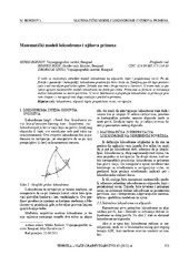
Mathematical models of rhumb line and their application / Matematički modeli loksodrome i njihova primena
(Savez inženjera i tehničara Srbije, Beograd, 2011)
The paper analyses some models of rhumb line on the ellipsoid, sphere and map projection. In geodesy and cartography, rhumb line is a complex curve on the earth's surface that crosses every meridian at the same oblique ...
Concept of implementation of consolidation in Serbia / Koncept sprovođenja komasacije u Republici Srbiji
(Savez inženjera i tehničara Srbije, Beograd, 2016)
Land consolidation means a system of spatial planning, technical, legal and socio-economic measures takes by the community for a fundamental improvement of natural, economic and environmental conditions of the land territory ...

Real estate appraisal and its role in sustainable Republic of Serbia real estate market development / Procena vrednosti nepokretnosti i njena uloga u održivom razvoju tržišta nepokretnosti u Republici Srbiji
(Savez inženjera i tehničara Srbije, Beograd, 2012)
Most of the developed countries have accepted the concept of calculating property tax based on the value of real estate. To be able to determine the value of real estate over the same time, undertook the creation of models ...

Značaj geodetskog inženjerstva u inženjersko-tehničkim oblastima
(Savez inzenjera i tehnicara Srbije, 2020)
Rad se bavi zakonskim utemeljenjem uloge geodetske delatnosti u oblasti građevinskog inženjerstva u Republici Srbiji. Ukazuje se na permanentno umanjenje uloge geodetske struke u praksi što može dovesti do ozbiljnih posledica ...

Integration of CAD and GIS technology using ArcGIS for development of building information systems / Integracija CAD i GIS tehnologije za potrebe izrade informacionih sistema objekata korišćenjem ARCGIS-a
(Savez inženjera i tehničara Srbije, Beograd, 2014)
Paper will present basic definitions and significance of implementation of information systems for facility maintenance, as well as terms Facility management (FM) and FM lifecycle. The main focus of this paper is on CAD ...