
Search
Now showing items 251-260 of 266

Planning for sustainable development of local municipality / Planiranje održivog razvoja jedinice lokalne samouprave u Republici Srbiji
(Savez inženjera i tehničara Srbije, Beograd, 2012)
The problem of Sustainable Municipality development in Republic of Serbia is quite specific. All official agree that the development is quite slow or stopped. Forming the new association of communities and towns the process ...
Positional accuracy of geographical information and recent standards for its evaluation / Položajna tačnost geografskih informacija i savremeni standardi za njeno ocenjivanje
(Srpsko geografsko društvo, Beograd, 2011)
Positional accuracy is important quantity element of quality of geographical information in digital as well as in analoguos form. This paper points to importance and necessity of evaluation of positional accuracy in recent ...
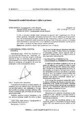
Mathematical models of rhumb line and their application / Matematički modeli loksodrome i njihova primena
(Savez inženjera i tehničara Srbije, Beograd, 2011)
The paper analyses some models of rhumb line on the ellipsoid, sphere and map projection. In geodesy and cartography, rhumb line is a complex curve on the earth's surface that crosses every meridian at the same oblique ...
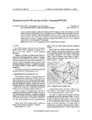
Twenty years from the first GPS measurements in Serbia: Campaign EPVGI90 / 20 godina od prvih GPS merenja u Srbiji - kampanja EPVGI90
(Savez inženjera i tehničara Srbije, Beograd, 2010)
This paper describes measurements and shows the results of the first GPS campaign taken in Serbia, realized by Military Geographical Institute from Belgrade in July 1990, within its Experimental geodetic network. As a ...
Landslide susceptibility assessment using SVM machine learning algorithm
(Engineering Geology, 2011)
This paper introduces the current machine learning approach to solving spatial modeling problems in the domain of landslide susceptibility assessment. The latter is introduced as a classification problem, having multiple ...
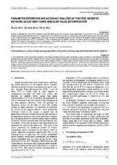
Parameter estimation and accuracy analysis of the free geodetic network adjustment using singular value decomposition
(Faculty of Mechanical Engineering in Slavonski Brod, Faculty of Electrical Engineering in Osijek, Faculty of Civil Engineering in Osijek, 2014)
In order to determine the vector of the coordinates of the free geodetic networks by the least square adjustment, it is necessary to solve a singular system of linear equations and to find the inverse of a singular matrix. ...
Потпуни метод најмањих квадрата у функцији решавања геодетских проблема
(Универзитет у Београду, Грађевински факултет, 2016)
Doktorska teza je posvećena primeni tehnike potpune metode najmanjeg kvadrata...
A presentation method of students’ assignment in geometry-intersection of two surfaces of second order
(Serbian Society for Geometry and Graphics (SUGIG)Faculty of Civil Engineering, University of BelgradeAkademska misao, Beograd, 2016)
There are two courses concerning geometric topics in the freshman studies at the Faculty of Civil Engineering in Belgrade: Descriptive Geometry for civil engineers and Computational Geometry, for geodetic engineers. In the ...
Rockfall simulation on a rock slope along E75 road at km 890+725 to 891+093
(Willey Ernst and Sons, 2018)
The section of E75 motorway under construction was subjected to simulation of potential rockfall hazard. 3D point-cloud surface model of the rock slope, obtained by a combination of LiDAR and UAV techniques, was used for ...
Impact of New Technologies for Spatial Data Acquisition and Management on Land Consolidations in Serbia
(INTERNATIONAL SCIENTIFIC CONFERENCE AND XXIV MEETING OF SERBIAN SURVEYORS ″″″″PROFESSIONAL PRACTICE AND EDUCATION IN GEODESY AND RELATED FIELDS″″″″ 24-26, June 2011, Kladovo - ,,Djerdap“ upon Danube, Serbia, 2011)
Significant innovations and improvements in the technologies for spatial data acquisition and management data
have emerged in the last few decades. Introduction of GPS and the technology of GIS and digital photogrammetry ...